
Field examination of these sites has been undertaken across the UK. However, more detailed topographical surveys have been carried out within areas rich in early mining remains.
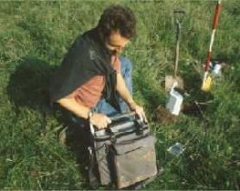
Soil geochemical surveys have been undertaken to help detect early mining and smelting
sites using a portable XRF (X-
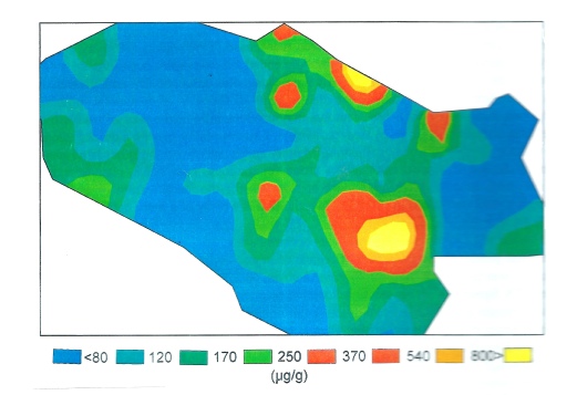
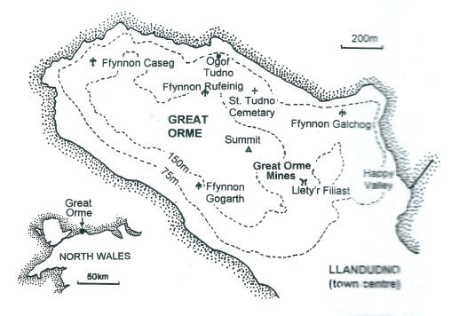
This has yielded useful results on the Great Orme’s Head, Llandudno (N.Wales) where
areas of Bronze Age mining and ore washing at spring sites suggested by the distribution
of high copper anomalies as revealed by spatial mapping and sampling at 50-
Copper as ppm in soils courtesy of D. Jenkins/A.Owen.
This website was made possible by a grant from the Cambrian Archaeology Association

At Cwymystwyth in Mid-
A survey and excavation also took place, at the Great Doward Iron Mine (Pancake Mine) in the Forest of Dean, Gloucestershire in 2017.
Sampling soils at Alderley Edge in 1997 (S. Timberlake)
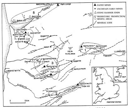
Field work has been carried out in mid-
These sites have been identified by the presence of the ubiquitous stone mining hammers and other tools (hammer/anvil stones), small eroded pits and open cuts on copper/lead veins, as well as overgrown shallow spoil mounds with weathered fire set mine waste and charcoal.
Map shows mines (triangles), mineral lodes (dotted lines) and prospection areas (S. Timberlake)
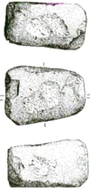
Pyllau Opencast Bronze Age Mine.
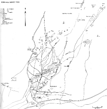
Sample of detailed topographical archaeology survey of Copa Hill, Cwmystwyth 1989-